Related Stories

Water Sampling
During this expedition we will be sampling ocean water at depths of <500 to & ...
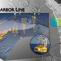
Mapping Washington Ma
The coastal margin west of Grays Harbor WA will host three uncabled moorings as ...
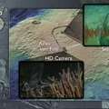
Mapping Axial Volcano
In 2013, as part of NSF's Ocean Observatories Initiative, Axial Volcano will be ...
Operations
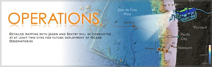
Operations on the Enlighten'10 expedition are focused on obtaining meter-scale bathymetric maps and high-definition imagery of proposed cabled and uncabled study sites as part of the National Science Foundation's Ocean Observatories Initiative. In 2013, a network of cabled geophysical, chemical and biological sensors will be installed on the Juan de Fuca plate that will allow 24/7/365 interactivity and monitoring of key oceanographic processes as part of the Ocean Observatories Initiative. Operations during this cruise will lay the foundation for installation of the transformativeRegional Scale Nodes infrastructure.
Operations include:
- Use of the R/V Thompson, operated by the University of Washington, to map the seafloor using an EM300 hull-mounted swath sonar system. Equipment onboard the Thompson will also be used to monitor ocean currents and chemistry in real-time and to take water and sediment samples
- High-bandwidth ship-to-shore communications using a Galaxy 18 satellite system for distribution of results during the cruise and for daily updates on operations, science, and education.
- Use of the robotic vehicle Jason and autonomous vehicle Sentry (operated by the U.S. National Deep Submergence Facility) to obtain meter-scale bathymetric maps of the seafloor and to direct high-defintion and digital-still imagery of cabled and uncabled infrastructure sites
