Related Images and Videos : View All
Southern Hydrate Ridge V15
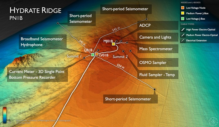
Southern Hydrate Ridge Study Site (Primary Node: PN1B)

Hydrate Ridge Details image

Southern Hydrate Ridge Bathymetry
Location: 44.6ºN 125.1ºW Water Depth: 780-771 meters
The Southern Hydrate Ridge study site (~10 km north of Primary Node PN1B) hosts abundant deposits of frozen methane (methane hydrates) that are buried beneath the seafloor. The deposits vent methane-rich fluids and bubbles that escape through seeps on the ocean bottom. Dense and fascinating communities of microbes and animals are fueled by these escaping gases. Methane is a powerful greenhouse gas and, therefore, quantifying the flux of methane from the seafloor into the hydrosphere is critical to understanding carbon-cycle dynamics and the impacts of global warming on methane release.
