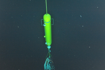
The Deep Profiler at Axial Base docked in its charging station at the bottom of the mooring. The yellow profiler vehicle climbs up and down the mooring wire between the seafloor and the top buoy, collecting oceanographic data on thin layers in the water column.
Photo Credit: NSF-OOI/UW/CSSF, Dive 1742, VISIONS14
Location: 46.1082ºN 129.6182ºW Water Depth: 2650-2654 meters Primary Node: PN3A
The study site at the base of Axial Seamount is far from the continental shelf (>350 km) and represents an open-ocean or pelagic site in the continuum of observing scales represented in the OOI's cabled system. Here, large-scale currents including the North Pacific Current, the subpolar gyre and the northern end of the California Current interact. These currents transport heat, salt, oxygen, and biota, all of which are crucial to the region's ecosystem.
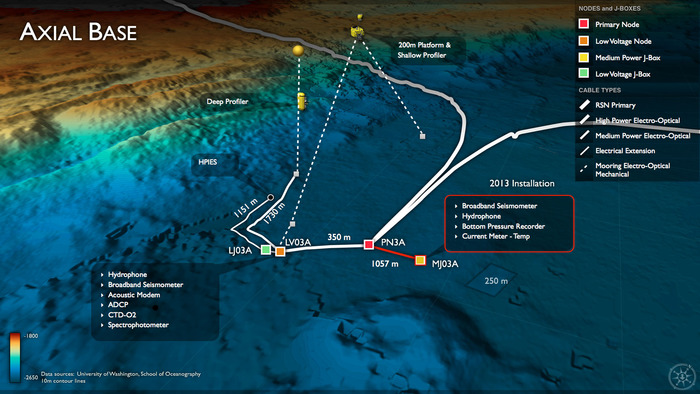
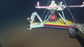
During Leg 2 of VISIONS'14, the Deep Profiler mooring hosting an instrumented wire crawler was installed, as well as a series of junction boxes, extension cables, and instruments (e.g., HPIES and a broadband seismometer).
During Leg 5 of VISIONS '14, the Shallow Profiler vertical mooring is scheduled to be installed at Axial Base at PN3A. This will entail using the ROV ROPOS to connect the EOM cable to the previously deployed junction box, installing the platform instrument pod onto the 200 m platform, and installing the Shallow Profiling winch assemby and instrument pod. During ROV downtimes, vertical CTD casts are planned to collect samples for instrument verification.


