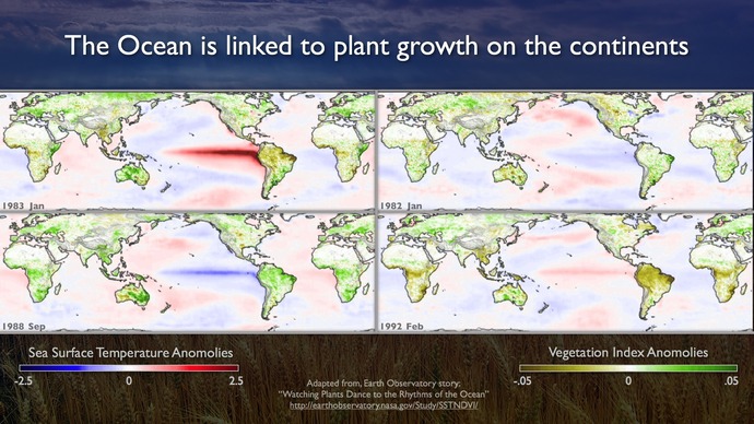
As the “environmental flywheel” of the planet, the oceans regulate climate and weather by redistributing heat between the equator and the poles. It is the largest biome on the planet with marine organisms providing 50% of Earths oxygen supply. The oceans are central to the quality of life on Earth. However, our lack of ability to make sustained measurements in the oceans for long periods of time has hampered understanding the complex relationships among the oceans, the atmosphere, and the continents. The full effect of climate cycles—such as El Niño— are difficult to quantify using only satellites and limited measurements from ships.
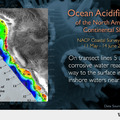
The continuous and long-term sampling capabilities of OOI infrastructure will transform our understanding of these ocean-atmosphere processes that are crucial to the habitability of life on Earth. With these ocean observing capabilities, scientists will be equipped to vastly improve knowledge of the interaction of the water off the Pacific Northwest with remote ocean regions and the atmosphere above; the evolution of the dynamics and structure of this region as it transitions from deep water to shallow water; and the magnitude and impacts of ocean acidification and driving forces for harmful algal blooms.
Improved quality and quantity of data from this region as delivered by a diverse array of sensors on the seafloor and throughout the water column at key locations will drive improvements in computer models and simulations of ocean/atmosphere interaction. These data will allow better regional meteorology and promote more reliable predictions of strong atmospheric events off the Pacific Northwest, such as damaging winter storms. Better models will also assist prediction of how these events evolve as they make landfall, move eastward and onto the North American continent, and how they, for example, contribute to the hydrological cycle of the Pacific Northwest and the rest of North America.
A range of globally significant oceanographic features exists in the Northeast Pacific: the West Wind Drift (WWD) is a major current that forms the boundary between the subtropical (Central Pacific Gyre) and subarctic (Subarctic Current, Alaska Gyre) ocean systems in the North Pacific. Each feature has different physical, biological, and biogeochemical characteristics. The position of the West Wind Drift may migrate north and south by as much as 600 miles with changes in the seasons.
The WWD bifurcates to produce the Alaska Current flowing north and the California Current flowing south along Washington, Oregon and California. The area where this eastern boundary current flows is characterized by frequent strong winter storms, seasonal wind reversals, moderate upwelling in spring and summer, significant freshwater runoff, strongly seasonal primary and secondary production, and patchy spawning by fish. Such eastern boundary currents occur throughout the world’s oceans yet, despite their importance, little is understood about their complexities and variations. By studying one such system well off the Washington and Oregon coasts, we will be better informed about all such systems.


