Related Stories
At-Sea Immersion Prog
For over two decades the University of Washington has enabled at-sea experiences ...
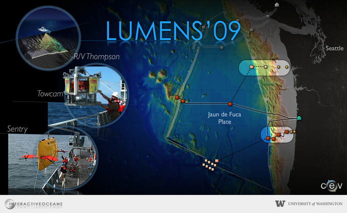
The LUMENS'09 Expedition
Adaptation to changing circumstances

The R/V Thompson is about to leave the Ballard locks during the LUMENS'09 cruise

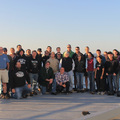
The R/V Thompson in the Todd Shipyard dry dock in 2009. Students and instructors are in the foreground.
The LUMENS '09 expedition--scheduled for 1 - 15 August 2009--got only as far as the Ballard Locks before the R/V Thompson experienced serious mechanical problems and the cruise was cancelled. There is no archived website.
Summary of LUMENS '09 Activities
Lumens'09 was to be a collaborative effort between the University of Washington, Oregon State University, Arizona State University and the OOI. The UW had provided ship time on the R/V Thompson, ASU provided funding for the Woods Hole Oceanographic Institution deep towed camera system, and the OOI provided funds for the autonomous vehicle Sentry.
The cruise was scheduled from August 1 to August 15 with the major goal of mapping node sites from Hydrate Ridge east towards Newport Oregon, and west of Grays Harbor, Washington. A competetive application process resulted in the participation of nine UW students, three students from OSU, and a student from the College of Charleston and ASU.
This "cruise" became a learning experience centered on rapid adaptation to changing circumstances: the Thompson experienced electrical, thruster and z-drive problems as we transited out of the Ballard Locks. These malfunctions required us to transit down to Todd Shipyard and tie up the evening of August 1.
The students and science party stayed on the ship, held daily meetings, and worked on science problems using data collected in 2008 on the INSITE08 cruise. Spirits remained high and there was hope for a quick repair. Unfortunately, this was not possible and on Thursday, August 6, the science team moved off the ship and the cruise was officially terminated. The UW team returned to campus to complete the two-week intense education program.
The students formed strong bonds working together on projects using high-resolution bathymetry, chemical data, and digital still images of Hydrate Ridge and Axial Seamount. The students continued to work hard on their projects and on August 14 they discussed their results with the team during a series of presentations.
