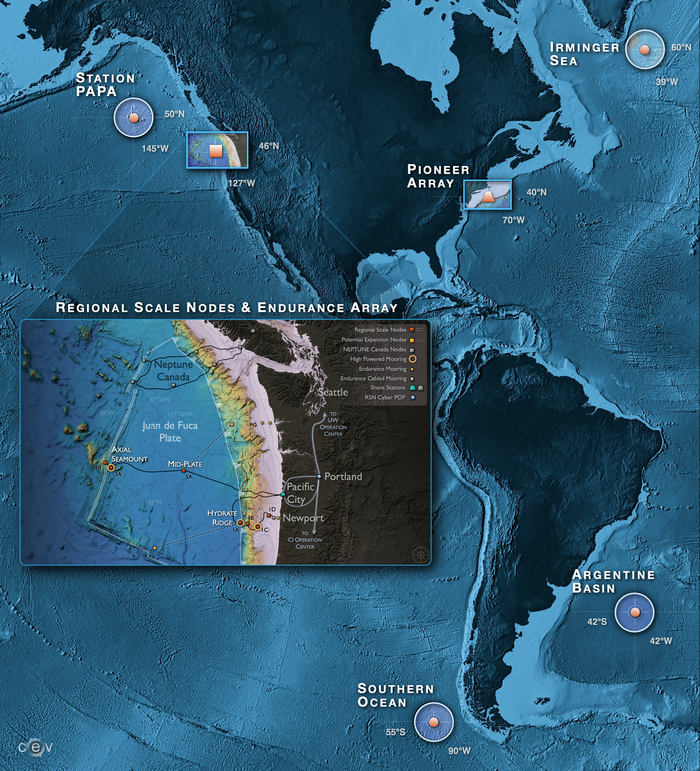
Maps Related to RSN and OOI

The Cabled Array high power and bandwidth fiber optic cables extend from coastal to blue water environments, that include the Cascadia Subduction Zone and the largest volcano off of the Washington-Oregon coast, Axial Seamount. The ~ 900 km of cable provides two-way communications and data flow at the speed of light to 140 instruments and 2900 m-tall moorings with instrumented profilers that have been operational since 2015. Credit: University of Washington.
This web page provides links to the following maps:
A concise, one-page OOI cabled observatory Fact Sheet is available here.
