Related Stories
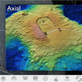
Axial Volcano
Understanding Submarine Volcanoes Two of the out
Endurance Line
The coastal Endurance Array component of OOI will observe cross-shelf and along- ...

Washington Uncabled L
Washington Uncabled Line The backbone of the Washington Line will be three f ...
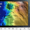
Hydrate Ridge
A significant amount of methane near the surface of the Earth is locked in gas h ...
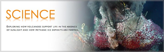
Enlighten Science
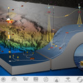
The University of Washington is leading the effort to develop the Regional Scale Nodes (RSN) component of the National Science Foundation's Ocean Observatories Initiative. This cabled underwater research facility will be constructed in the northeast Pacific Ocean off the coast of Oregon. This cruise lays the foundation for installation of the secondary infrastructure (nodes, junction boxes, sensors, moorings, and extension cables) on the high-power (up to 200 kW) and high-bandwidth (up to 480 Gb/s) RSN cabled observatory.
There will be four main work areas during Enlighten '10:
- An ~800 m deep site ~50 nm west of Newport, OR. At this location, high resolution bathymetric and detailed seafloor surveys of methane seeps will be completed at the summit of Southern Hydrate Ridge.
- A ~1500 m deep site located at Axial Seamount ~260 nm west of Newport, OR where high resolution bathymetric and detailed seafloor surveys will be completed to determine installation sites for nodes, junction boxes, sensors, and extension cables.
- A ~500 m deep site ~30 nm west of Grays Harbor, WA where bathymetric and seafloor observations will be conducted to determine the placement of an uncabled mooring (the Washington Uncabled Line) as part of the OOI Coastal Scale Nodes (CSN).
- A ~585 m deep site ~40 nm southwest of Newport, OR where local seafloor and bathymetric surveys will help to determine the optimal placement of a cabled mooring (the Endurance Line) shared between RSN and CSN.
