Terms
Privacy
NSF Disclaimer
News
Contact Us
People
Search
Home
About
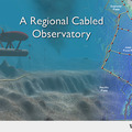
Regional Cabled Array
North East Pacific
Maps
Observatory Sites
Schedule
History
Partners
OOI
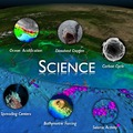
Research
Methane Hydrates
Volcanoes
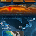
Earthquakes in the NE Pacific
Climate Change
Oceans and Life
Carbon Cycle
Ocean Acidification
Societal Implications
Education
Informal Science Education
At Sea Education Program
Learning via Telepresence
Technology
Cabled Network
Cables
Nodes
Junction Boxes
Connectors
Sensors
Moorings
Shore Station
ROV Systems
Research Vessel Thompson
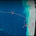
Sites
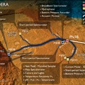
Slope Base (PN1A)
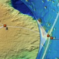
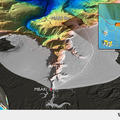
Southern Hydrate Ridge (PN1B)
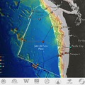
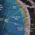
Endurance Line (PN1C and PN1D)
Mid-Plate (PN5A)
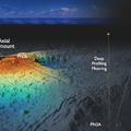
Axial Base (PN3A)
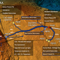
Axial Caldera (PN3B)
Expeditions
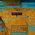
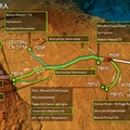
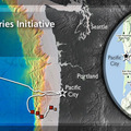
VISIONS'18
VISIONS'17
VISIONS'16
Overview and Goals
Participants
VISIONS'15
VISIONS'14
Overview and Goals VISIONS '14
Participants VISIONS '14
VISIONS'13
VISIONS'12
VISIONS'11
Enlighten'10
LUMENS'09
INSITE'08
VISIONS'05
Video
Blogs
Resources
Video
Image Gallery
Poetry
Biology
Axial Biology
Arthropods
Ciliates
Cnidaria
Echinoderms
Fish
Mollusks
Polychaetes
Salps
Coastal Biology
Mollusks
Fish
Echinoderms
Cnidaria
Arthropods
Tags
Animal
Animations
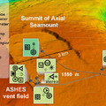
ASHES
Axial
Axial Base
Axial Biology
Basalt
Camera
Central Caldera
Coastal Biology
COVE
Deep Profiler Mooring
Earthquakes
Eastern Caldera
Endurance Array
ENLIGHTEN10
Exploratorium
Extreme Environments
Feasibility Study
Featured
Fish
Gastropod
Hydrate Ridge
Hydrates
Hydrothermal Vents
Inshore 80 m
Internatonal District
Jason
J-BOX
Jelly Fish
Junction Box
lllustration
LUMENS09
MARS
Mollusk
Moorings
NEPTUNE
Nodes
NSB1
Ocean Acidification
OCM
Octopus
OOI
Oregon Offshore 600 m
People
PN1D
Primary Node
Rockfish
ROCLS
ROPOS
ROPOS Dives
RSN
RV Revelle
RV Thompson
Sample
SC13
Seafloor
Seismometer
Sensors
Shallow Profiler Mooring
Shipboard
Shore Station
Sikuliaq
Slope Base
Smoker
Soft Coral
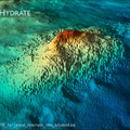
Southern Hydrate Ridge
Students
Tsunamis
Tubeworms
Visions11 Leg 1
Visions11 Leg 2
VISIONS11 viewers
VISIONS12
VISIONS 13
VISIONS14
VISIONS15
VISIONS16
VISIONS17
Visions18
Visualization
Volcanoes
VSIONS12 Video
WM Keck
Visualization
Videos
ROPOS 3D Dive Movie
Images
Axial Seamount Complete and Connected
COVE Southern Hydrate 1
COVE Southern Hydrate 2
COVE Southern Hydrate 3
COVE Southern Hydrate 4
Hydrothermal Vent Model
Main Endeavor Vent Field
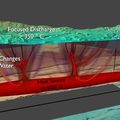
Endeavor Vent Field Mechanics
Axial Caldera ROPOS Dive 1727
Axial Caldera Installation 2014
Global Oceans
Safety Advisory Image Example 2
Axial Status 2013
Axial Summit Infrastructure Installed in 2013
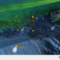
ROV 3D dive
axial overview
axial firstpreson
Axial Base Deployments 2013
Offshore Endurance
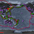
OOI Map
OOI RSN Cable System Map
PN5A-Overview Image
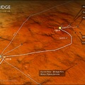
PN3B-Overview Image
PN3A-Overview Image
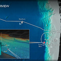
PN1C and PN1D Overview Image
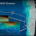
PN1B-Overview Image
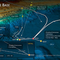
PN1A-Overview Image
Axial Caldera Image
Instruments at the ASHES vent field
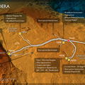
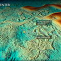
Central Caldera Site Axial Seamount
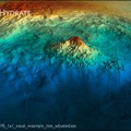
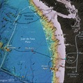
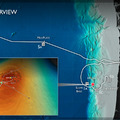
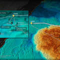
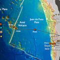
Hydrate Ridge Details image
Axial Slope Base Image
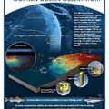
Coastal Upwelling
Southern Hydrate Ridge PN1B
Cabled and Uncabled OOI Sites off WA and OR
Moorings off the Oregon Margin
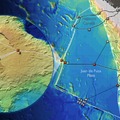
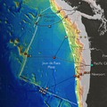
RSN Footprint
Research Primary Image
Plan for OOI RSN Primary Node Installation
VISIONS12 Overview
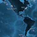
Sister Observatories
PN3B Axial Seamount
PN3A Axial Seamount
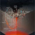
ASHES Hydrothermal Field
Axial Volcano and Associated Vent Fields
Theme IV banner
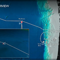
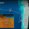
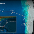
Glider Dive Plan
OOI-RSN Map
The Ocean Observatories Initiative
Cable Landing Invite Image
RSN Science Themes
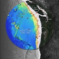
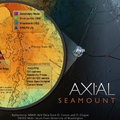
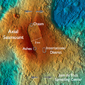
Axial Seamount
VISIONS11 Plan
Axial Caldera Seafloor
Axial Secondary Infrastructure
RSN Plan View
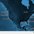
NANOOS
2009 OOI Poster
MARS
Earthquakes in the NE Pacific
New Medicines
Nodes Image
Oceans and Humans
test big image
EMSO-ESONET
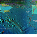
Keck locator map
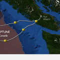
NEPTUNE Canada map
Node on seafloor
Conceptual View of Future Seafloor Laboratory
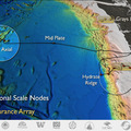
Regional Scale Nodes
NEPTUNE Cable System 2005
IOOS Map
Earth-Ocean Processes Bottom Half
Volcanoes and Life Axial Seamount
Observatories - Hydrate Ridge
Observatories - Endurance Array
 Axial Seamount Complete and Connected
 COVE Southern Hydrate 1
 COVE Southern Hydrate 2
 COVE Southern Hydrate 3
 COVE Southern Hydrate 4
 Hydrothermal Vent Model
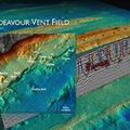 Main Endeavor Vent Field
 Endeavor Vent Field Mechanics
 Axial Caldera ROPOS Dive 1727
 Axial Caldera Installation 2014
 Global Oceans
 Safety Advisory Image Example 2
 Axial Status 2013
 Axial Summit Infrastructure Installed in 2013
 ROV 3D dive
 axial overview
 axial firstpreson
 Axial Base Deployments 2013
 Offshore Endurance
 OOI Map
 OOI RSN Cable System Map
 PN5A-Overview Image
 PN3B-Overview Image
 PN3A-Overview Image
 PN1C and PN1D Overview Image
 PN1B-Overview Image
 PN1A-Overview Image
 Axial Caldera Image
 Instruments at the ASHES vent field
 Central Caldera Site Axial Seamount
 Hydrate Ridge Details image
 Axial Slope Base Image
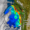 Coastal Upwelling
 Southern Hydrate Ridge PN1B
 Cabled and Uncabled OOI Sites off WA and OR
 Moorings off the Oregon Margin
 RSN Footprint
 Research Primary Image
 Plan for OOI RSN Primary Node Installation
 VISIONS12 Overview
 Sister Observatories
 PN3B Axial Seamount
 PN3A Axial Seamount
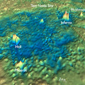 ASHES Hydrothermal Field
 Axial Volcano and Associated Vent Fields
 Theme IV banner
 Glider Dive Plan
 OOI-RSN Map
 The Ocean Observatories Initiative
 Cable Landing Invite Image
 RSN Science Themes
 Axial Seamount
 VISIONS11 Plan
 Axial Caldera Seafloor
 Axial Secondary Infrastructure
 RSN Plan View
 NANOOS
 2009 OOI Poster
 MARS
MARS
 Earthquakes in the NE Pacific
 New Medicines
 Nodes Image
 Oceans and Humans
 test big image
 EMSO-ESONET
 Keck locator map
 NEPTUNE Canada map
 Node on seafloor
 Conceptual View of Future Seafloor Laboratory
 Regional Scale Nodes
 NEPTUNE Cable System 2005
 IOOS Map
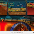 Earth-Ocean Processes Bottom Half
 Volcanoes and Life Axial Seamount
 Observatories - Hydrate Ridge
 Observatories - Endurance Array
